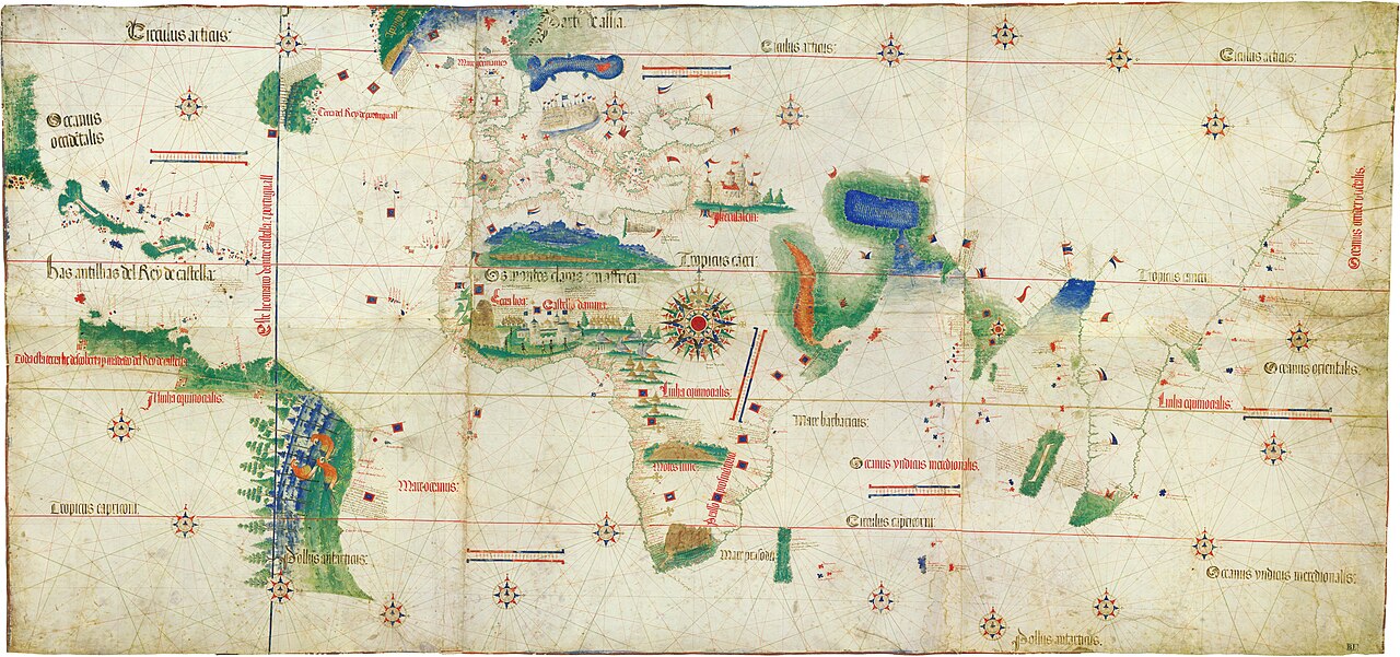



The Cantino Planisphere, dated 1502, is the earliest surviving map to show the discoveries of the Portuguese voyages of the 1490s and early 1500s. The map depicts the coastlines of Africa around the Cape of Good Hope (Vasco da Gama's 1497-1499 route to India), the eastern coast of South America following Pedro Álvares Cabral's 1500 landfall in Brazil, and the Caribbean from Columbus's expeditions. The Tordesillas line of 1494, the Spain-Portugal demarcation of the New World, is drawn through the South Atlantic.
The map was commissioned by Alberto Cantino, an Italian agent of the Duke of Ferrara, who paid an unnamed Portuguese cartographer twelve gold ducats for it. The Portuguese crown jealously guarded its cartographic information at this period, the Padrão Real (Royal Pattern) master map was a state secret, so the Cantino Planisphere is a smuggled copy. It is the single most important surviving cartographic artifact from the Portuguese Age of Discovery.
The planisphere is held at the Biblioteca Estense Universitaria in Modena, Italy, where it has been since 1592. Its survival is the result of an Italian diplomatic-espionage success; without Cantino's commission the Portuguese state cartography of c. 1500 would be substantially less documented. The map is the foundation document of early modern European maritime commerce and the visual record of the moment when the Portuguese trade routes around Africa to India became operational.